New radar data reveals Alaska’s glaciers are melting longer and reacting faster to heat.
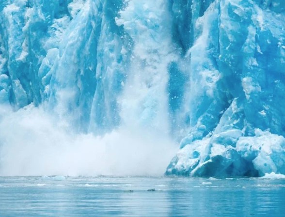
Alaska’s glaciers are not just shrinking. They are staying in melt mode for longer stretches of the year.
Using satellite radar, researchers found that for every 1 degree Celsius (1.8 degrees Fahrenheit) increase in average summer temperature, glaciers across Alaska experience about three extra weeks of melting. That kind of shift matters because a longer melt season gives glaciers less time to rebuild snow and ice, increasing the odds of long-term ice loss.
The study, published in npj Climate and Atmospheric Science, also shows that synthetic aperture radar, or SAR, can track glacier conditions throughout the year with far more consistency than standard optical methods.
A New Way to Track Glacier Change
The research was led by Albin Wells, a recent Ph.D. graduate from Carnegie Mellon University. Co-authors include David Rounce, an assistant professor at Carnegie Mellon, and Mark Fahnestock of the University of Alaska Fairbanks Geophysical Institute. Rounce previously worked at the institute as a postdoctoral fellow and research associate.
Using SAR data, the team measured glacier “melt days.” This term can refer to a full 24-hour period when an entire glacier is melting, or several days during which partial melting adds up to the glacier’s total surface area.
An increase in melt days points to a longer melt season and faster overall ice loss.
The researchers analyzed data from the European Sentinel-1 radar satellite, tracking seasonal changes across nearly all Alaska glaciers larger than about half a square mile from mid-2016 through 2024.
SAR works by sending microwave pulses toward Earth from a satellite or aircraft and combining the returning signals to create detailed images. This method works through clouds and in darkness. Sentinel-1 revisits the same location every 12 days and monitors more than 3,000 glaciers across Alaska.
The study also found that short-term heat waves can strip away up to 28% more protective snow cover than in typical years. This estimate applies at the scale of mountain ranges rather than to each individual glacier.
“Our ability to quantify these changes is really important,” Wells said. “Melt extents and snowlines are proxies for glacier mass balance.”
Understanding Glacier Mass Balance and Snowlines
Glacier mass balance describes the difference between how much ice and snow a glacier gains and how much it loses over time.
“These correlations with temperature begin to give a sense for how much melt or snowline retreat we can anticipate under future, warmer climates across the region,” Wells said.A glacier’s snowline separates two key zones. The accumulation zone is where snow builds up and adds mass, while the ablation zone is where melting removes ice and snow. Scientists usually rely on optical tools to map snowlines near the end of the melt season, typically in late summer or early fall.
In optical data, the snowline can be really hard to observe,” Fahnestock said. “If you’re a day late taking your picture, it might have snowed on the entire glacier, and you can’t see where the bare glacier ice is down below and where the snow and firn is above.”
Firn is partially compacted snow that forms near the top of a glacier and can eventually turn into ice. Fahnestock noted that optical measurements can be affected by lighting changes, shadows, cloud cover, and whether the firn surface is clean or dirty.
SAR avoids these issues and can deliver regular updates throughout the melt season.
“What Albin has done is operationalize the tracking of surface conditions on the glaciers in a way that can be applied anywhere,” Fahnestock said.
Heat Waves and Rapid Glacier Response
The study closely examined a major Alaska heat wave from June 23-July 10, 2019, which affected nearly all glaciated regions except the Brooks Range.
During this period, temperatures climbed 20 to 30 degrees above average for nearly two weeks. Several days set record highs, including 90 degrees Fahrenheit at Ted Stevens Anchorage International Airport. Typical summer highs in Anchorage are in the mid-60s.
This extreme heat pushed glacier snowlines upward by nearly 350 feet (about 107 meters), a level that is usually not reached until about two months later in the season.
As a result, more bare ice and firn were exposed for longer periods, increasing overall ice loss. The authors note that this highlights “the sensitivity of glaciers to short-term climatic variability.”
The researchers also identified clear differences in melt patterns between glaciers on the coastal side of mountain ranges and those farther inland. This suggests that glaciers respond differently depending on their location, even when overall ice loss rates appear similar.
“This is an important finding,” Wells said, “because it corroborates prior knowledge that glaciers in Alaska on the coastal side of mountains have more melt in summer and more accumulation in winter than those on the continental side of the ranges.”


comments


Other categories
Recent Comments